In the sample below we use the datacube.load command to load the RGB and Quality Assurance(QA) bands from the AWS Landsat archive. Landsat 8 has a return period of 16 days capturing over 24 snapshots a year so care should be taken when requesting a datacube as large geographical or time extents can quickly over fill memory and generate huge lag.
For our first visualisation we'll load a single time slice of the full geographical extent indexed and then proceed to select a smaller zone to explore through time.
It should be noted that images on AWS are referenced to WGS 84 so the extent bounds that are entered into the datacube.load() must match the coordinate system in which they're being stored.
The datacube.load() command also reprojects into a coordinate system in the below datacube load we automatically generate an EPSG code from the lat/long of the provided extent.
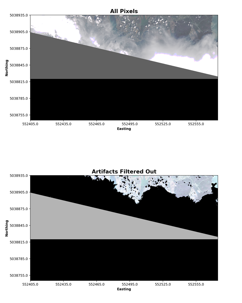
Next we'll explore Landsat 8 quality band, each pixel in the QA band contains unsigned integers that represent bit-packed combinations of surface, atmospheric, and sensor conditions that can affect the overall usefulness of a given pixel.
Used effectively, QA bits improve the integrity of science investigations by indicating which pixels might be affected by instrument artifacts or subject to cloud contamination. The ODC has in built methods that transform the metadata of a specific product to a libary of masking templates. For example, you are able to build a cloud mask directly from the ODC library.
We'll display the RGB bands that we have extracted from our cube for the first time slice (time = 0) in order to visualise a comprehendible RGB image we apply a histogram equalisation on each band before displaying. We'll also create visualisation of the pixels that are occluding land areas.